


bastidon

xav34830
User
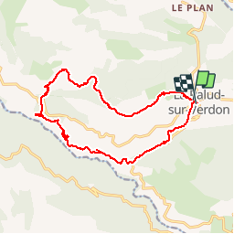

Length
18.4 km

Max alt
1383 m

Uphill gradient
1074 m
Km-Effort
33 km

Min alt
671 m

Downhill gradient
1083 m
Boucle
Yes
Creation date :
2014-12-10 00:00:00.0
Updated on :
2014-12-10 00:00:00.0
--
Difficulty : Medium

FREE GPS app for hiking
 SityTrail
IGN / Geographical institutes
SityTrail Plus
The world is yours!
About
Trail Walking of 18.4 km to be discovered at Provence-Alpes-Côte d'Azur, Alpes-de-Haute-Provence, La Palud-sur-Verdon. This trail is proposed by xav34830.
Positioning
Country:
France
Region :
Provence-Alpes-Côte d'Azur
Department/Province :
Alpes-de-Haute-Provence
Municipality :
La Palud-sur-Verdon
Location:
Unknown
Start:(Dec)
Start:(UTM)
285852 ; 4850883 (32T) N.
Comments
une des belles rando du Verdon - vue de la montagne , vue du canyon